My Waterbears
Tardigrade Reference Center
Dataset: All Collections
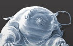
Taxa: Adropion scoticum (Hypsibius scoticus, Diphascon scoticus, Diphascon scoticum, Diphascon scoticum scoticum, Diphascon scoticum ommatophorum, Diphascon scoticum qinlingensis), Adropion scoticum ommatophorum (Hypsibius scoticus ommatophorus), Adropion scoticum qinlingensis (Diphascon scoticum qunlinge... (show all)
Search Criteria: Ireland; includes cultivated/captive occurrences
1
Page 1, records 1-0 of 0
Your query did not return any results. Please modify your query parameters
Google Map
Google Maps is a web mapping service provided by Google that features a map that users can pan (by dragging the mouse) and zoom (by using the mouse wheel). Collection points are displayed as colored markers that when clicked on, displays the full information for that collection. When multiple species are queried (separated by semi-colons), different colored markers denote each individual species.